

The best sailing apps for navigation, weather, and more
As much as we love to get out on the water and disconnect, we still have a soft spot in our hearts for the apps that make life afloat a little easier. Below are our fav apps that we use regularly. Let us know the sailing apps that you can’t live without in the comment box below.
SAILING NAVIGATION APPS
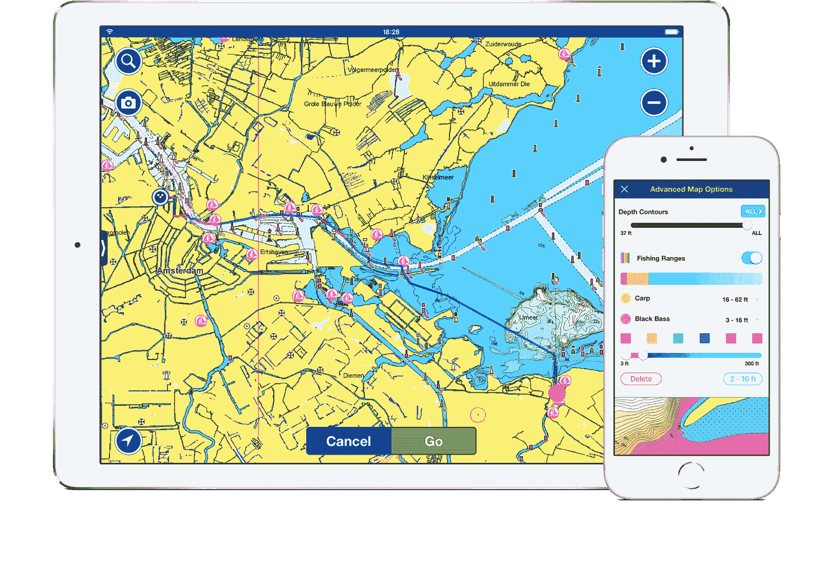
Navionics
For IOS and Android (FREE, charts sold separately)
Navionics has recently put out an exciting new update. In December 2018 they released a version which runs on both smartphones and tablets and includes an Active Captain overlay. As our backup navigation system this app has been invaluable! We use it for passage planning, double-checking our position, and when our Raymarine chartplotter glitches out. For those of you with wanderlust, we found that Navionics had the most accurate charting for Mexico. Worldwide maps are available and we would now take our iPad along on any charter boat excursion. Another feature we love is the apps’ compatibility with Raymarine products. I often plot all of our waypoints below deck on the iPad and then wirelessly upload it to our Raymarine chartplotter – how sweet is that!
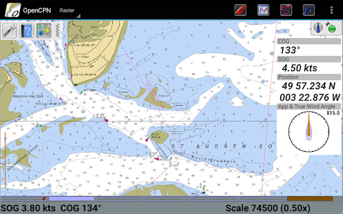
OpenCPN
For Android, Desktop Windows and Mac (FREE)
When it comes to navigation, who doesn’t love redundancy? Like many cruisers we are running OpenCPN on our laptop. We recently installed it on our and android phone as a backup. Having recently ditched paper charts on our boat, it’s nice to have a backup for your backup. OpenCPN does not contain charts so you have to download those separately. Free NOAA charts are available and work with OpenCPN as do CM93 world charts.
SAILING WEATHER APPS
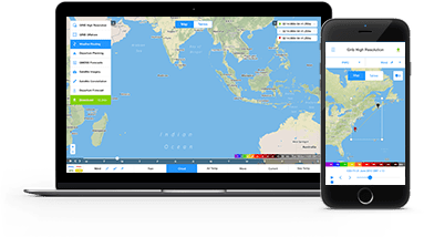
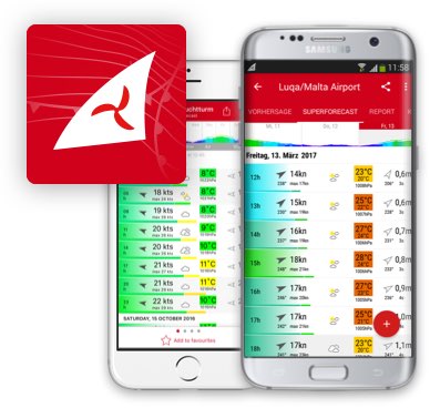
PredictWind
For IOS, Android, Desktop for Offshore version (Inshore version FREE, Offshore version by subscription)
PredictWind offers two great apps for weather forecasting: one for inshore and coastal sailing and another for offshore sailing. The inshore app displays high resolution weather forecasts, accessible by internet or mobile data and the offshore version additionally allows you to access GRIBS via a satellite or SSB connection. We used the offshore product on a Pacific crossing in 2017 and couldn’t have been happier with the results. The forecasts were very accurate and we could quickly download them over our Iridium Go connection. See our detailed review of the PredictWind Offshore app here.
Windfinder
For Android (FREE)
We find Windfinder works well for forecasting wind speeds but has been inconsistent for tide data. Good for planning a day-sail and checking current wind conditions at various locations.
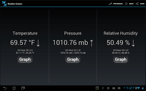
Weather Station
For Android (FREE).
Some smartphones have built in sensors to detect temperature, humidity, and barometric pressure. We use this app as a backup system to tell us about our current environment and we’ve found it to be as accurate as our Maretron Weather Station (a $700 piece of equipment). Robin has also used it for his work in the past as a building science engineer for diagnosing issues in buildings…it’s that accurate.
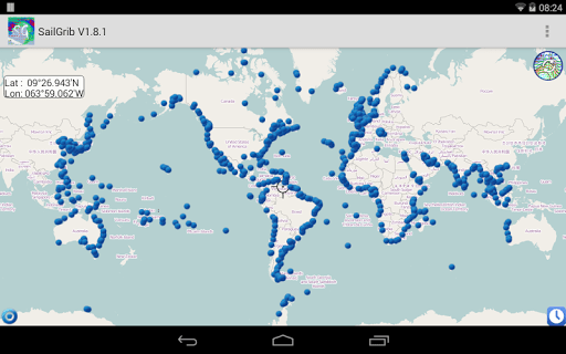
SailGrib
For Android (FREE)
This is our go to grib weather app. It’s nice for storing gribs offline and checking later when we no longer have cell connection. Interface is a bit glitchy on the zoom, but the data is quick.
OTHER SAILING APPS
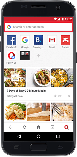
Opera Mini
For Android & Desktop Windows and Mac (FREE)
While not exclusively a sailing app, we love this web browser because it dramatically speeds up web browsing and reduces mobile data charges by eliminating ads and compressing images. While sailing in the South Pacific where internet was famously slow and expensive, Opera made it possible to connect. Infact, it’s even meant to allow you to browse over a satellite connection, though we never had any luck making this work with our Iridium Go.
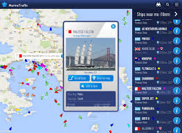
MarineTraffic
View any in-range vessel with AIS on a live map. We’ve used Marine Traffic to track down buddy boats, or follow family and friends on their cruising adventures. MarineTraffic recently added a neat new augmented reality feature that allows you to identify vessels around you by pointing your device to the horizon. It gives you all the information you need about the vessels: name, flag, speed, distance from you and a lot more.
Anchor Watch / Alarm
For Android (FREE)
Our chartplotter is in the cockpit (making it hard to hear the anchor alarm with the companionway closed). Also, we don’t like to keep the chartplotter on when we’re at anchor as it is networked to the depth sounder and AIS (which all combine to drain our batteries). So, we were excited to discover that there are several anchor alarm apps. We used an app called Drag Queen (which no longer seems to exists) but have heard good things about Anchor Watch / Alarm. Not only does it alert you when your vessels drifts out of your set parameters, but it will even send you an SMS message (a nice option if you’re going out of sight of the boat).
What do you think are the best apps for sailing? Let us know in the comment box below.
Fiona McGlynn is an award-winning boating writer who created Waterborne as a place to learn about living aboard and traveling the world by sailboat. She has written for boating magazines including BoatUS, SAIL, Cruising World, and Good Old Boat. She’s also a contributing editor at Good Old Boat and BoatUS Magazine. In 2017, Fiona and her husband completed a 3-year, 13,000-mile voyage from Vancouver to Mexico to Australia on their 35-foot sailboat.
Steve Hodges
Thursday 9th of May 2019
Good suggestions, thanks! I'd add SailFreeGPS (android only).
Stu9000
Thursday 28th of February 2019
@Rick... Respect your right to choose but paper goes out of date and it is easy make mistakes when you're tired. As someone old enough to remember what it was like to sail without an instant position fix I love the way Digital GPS linked charts take the stress out of sailing. To know which side of the sand bank you are on is worth a lot.
Love Navionics. Just love it. I can plan my route on the big screen laptop sitting in the club bar. Routes port to my tablet and phone. Even when off watch I can keep a weather eye on what is going on from my bunk.
Fred Hoefer
Thursday 21st of February 2019
Waterspeed is my favorite app for recording sailing plans and showing speed data, weather, wind direction and velocity forecasts and you can save all of your data for future review and comparison. It’s definitely worth checking out!
Fiona
Friday 1st of March 2019
Great suggestion! Thanks Fred
Jonathan
Sunday 17th of February 2019
Would like to recommend iNavX. iNavX uses NOAA charts and others. It also has an anchor alarm built in.
NOAA updates its charts frequently. Using iNavX its possible to have the most recent charts at all times. Commercial charts are updated less frequently. Sometimes, much less frequently.
Fiona
Friday 1st of March 2019
Thanks for the suggestion Jonathan!
Rick
Saturday 16th of February 2019
There's only one 'app' as far as I'm concerned, paper Admiralty charts and a pencil.......